GNSS Demystified
We all know what GPS is, but most have got a limited understanding of what the Global Positioning System actually is and what it truly is capable of. GPS (developed and owned by the US) was the first of it’s kind, however many other conglomerates joined the race, and today GPS forms part of the Global Navigation Satellite System (GNSS), along with other systems such as GLONASS (Russia), Galileo (Europe) and BeiDou (China), to name the biggest players. These systems are formally known as GNSS constellations, and they traverse the Medium Earth Orbit (MEO) plane, anywhere between 20000km and 36000km above the Earth.
Trilateration
By a gracious simplification, each of these systems basically work in the following way to achieve positioning (location) here on Earth, for an AsteRx RB3 Pro fitted with a PolaNt* MC v2 antenna:
It’s a bit of “Marco-Polo” in that the GNSS-chip in the receiver needs to find the satellites, while unaware of its own location. Each satellite constantly broadcasts a timestamp and its orbital position (collectively called ephemeris data) travelling at the speed of light in the form of radio waves which, similar to the beam from a flashlight, hits Earth and projects a ‘circle’ (satellite footprint) on the Earth’s surface. This practically creates the boundary of the signal’s coverage of Earth at any given point in time.
If the RB3 falls within such a circle – and with 30+ satellites overhead today this is nearly impossible not to happen – it essentially hears the “Marco”. It can then calculate how far it is from the satellite (pseudorange), which, within that beam, creates a single imaginary circle (sphere of precision) that curtails the receiver’s location to be anywhere along this circle. Two more satellites shout “Marco”, and with the three all making ‘circles’ on earth, where the three circles intersect is the estimated location.
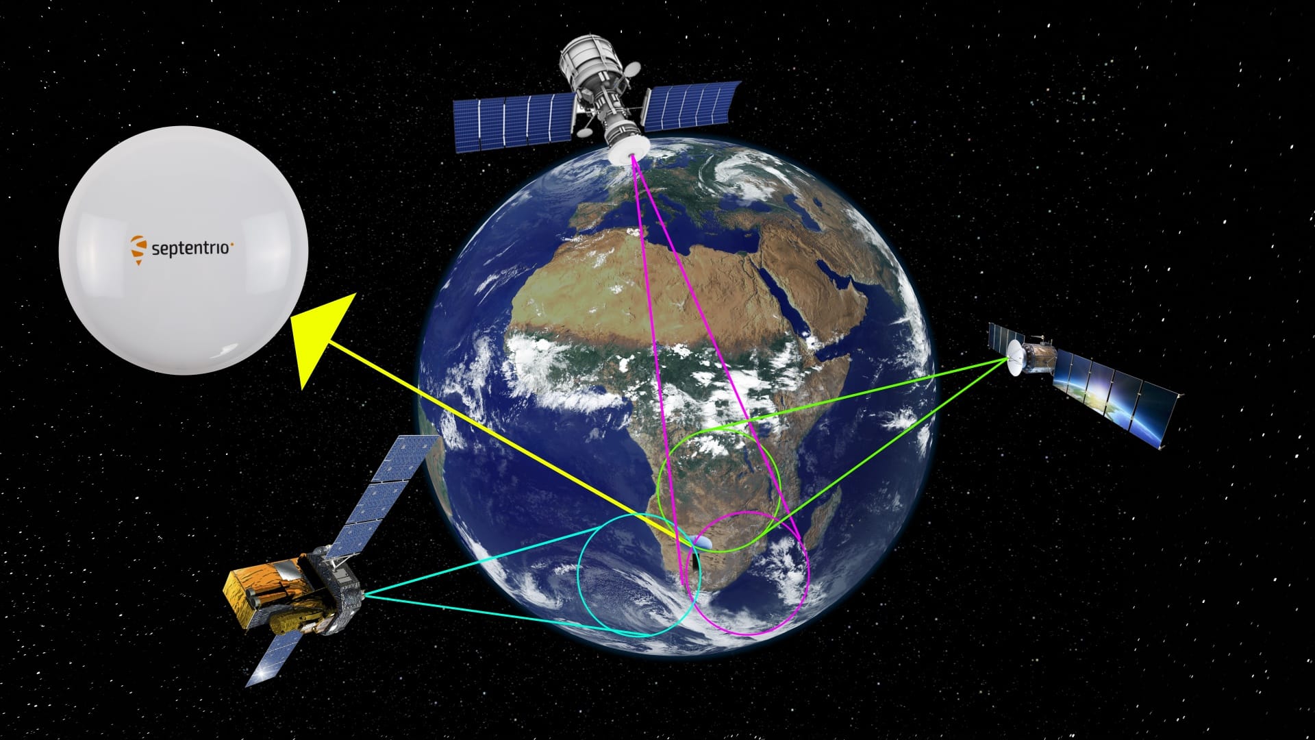
Trilateration: Where the 3 circles intersect, you have location
Pseudorange vs Carrier Phase
The distances from each satellite to the receiver, as illustrated above, is called the Pseudorange. The science behind this? The signal travels at roughly the speed of light, and each ‘pulse’ has a known wavelength, which is crucial for determining how far the signal has traveled. The calculation is basically to determine how many segments of these wavelengths (for ex, GPS L1 C/A is roughly 300m in length) it took to reach the receiver.
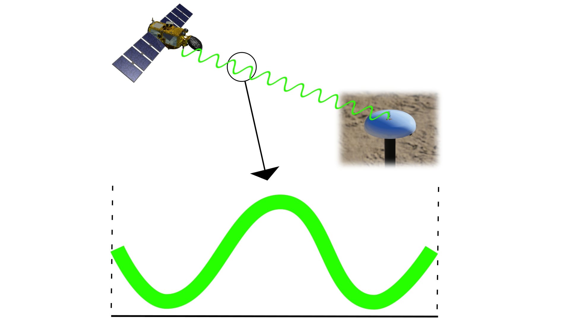
Pseudo Range: A single wavelength segment amplitude
So far, we have only utilised the data from the 3 intersecting satellites. Carrier Phase is where the 4th comes in. These satellites are in the region of 20000km+ above the Earth’s surface and the transmitted signal has a very long and arduous way to travel to reach your receiver’s antenna. This introduces incremental changes on paper, but in practice it can cause massive inaccuracies. Due to the magnitude of the distances involved, a single deviation of just one microsecond (0.0000001 s) would cause a distance error on Earth of 300m!
Interesting fact – the time provided by your phone, watch, even the news, is not the actual correct time, down to the nanosecond. Most clocks on Earth are too rigid and course to provide this, because of what is known as “clock drift”, and we make use of atomic clocks, highly specialized and sensitive, to get the actual time, as well as correct these errors. Since the distance measurement is based on time, if the time is wrong, the calculated distance is wrong. Enter satellite number 4: it is the universal time fixer for all GNSS solutions. It fixes the large time error that would otherwise throw your position off by hundreds of meters, reducing the remaining error to approximately 3-5 meters.
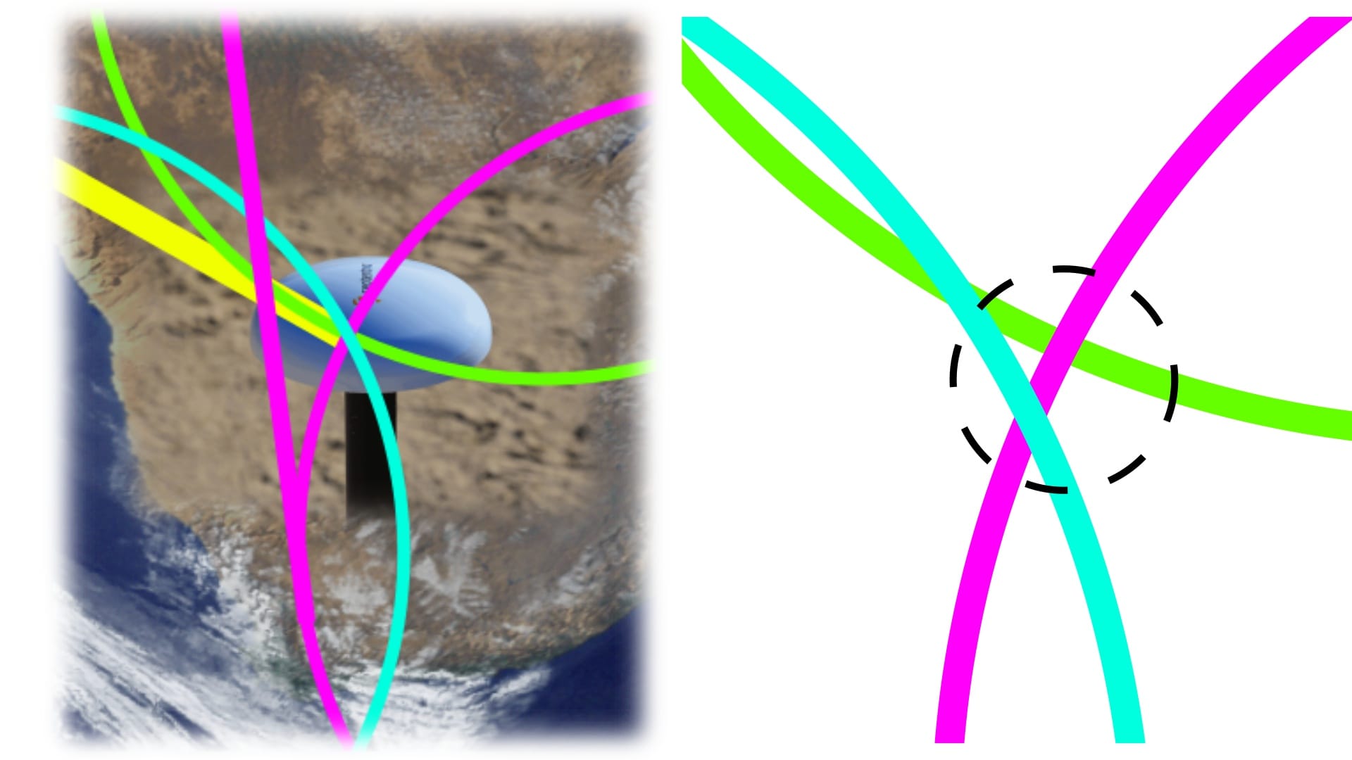
Integer Ambiguity: The intersecting lines need timing correction
Multi-frequency and multi-constellation?
The typical positioning device that most are acquainted with is usually limited to operating with a single constellation, usually GPS. The simplified explanation from above, is multiplied by a factor of the amount of satellites available at any given time. A single GNSS constellation can cover the entire planet with around 6 satellites. For perspective, GPS alone has 31 operational satellites, with a total of around 120 GNSS satellites orbiting the Earth.